


Weld 228, Weld County, Colorado
About
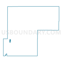
Outline

Summary
| Unique Area Identifier | 549356 |
| Name | Weld 228 |
| County | Weld County |
| State | Colorado |
| Area (square miles) | 4.35 |
| Land Area (square miles) | 4.35 |
| Water Area (square miles) | 0.00 |
| % of Land Area | 100.00 |
| % of Water Area | 0.00 |
| Latitude of the Internal Point | 40.30715410 |
| Longtitude of the Internal Point | -104.87570700 |
Maps


Graphs
Select a template below for downloading or customizing gragh for Weld 228, Weld County, Colorado


Neighbors
Neighoring Voting District (by Name) Neighboring Voting District on the Map
- Weld 201, Weld County, CO
- Weld 224, Weld County, CO
- Weld 232, Weld County, CO
- Weld 245, Weld County, CO
- Weld 246, Weld County, CO
- Weld 247, Weld County, CO